National Archives of FijiAppraising and Processing the Map Collection ProjectJune 30 - July 8, 2022
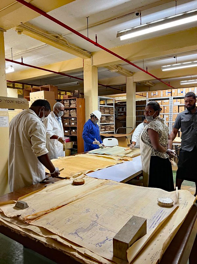
After a two year hiatus due to the Covid-19 pandemic, Island Culture Archival Support (ICAS) was back in the Pacific Islands working on a project at the National Archives of Fiji (NAF) with generous funding and support provided by the International Council on Archives Fund for the International Development of Archives (FIDA). The project dealt with taking physical and intellectual control of an extensive map collection that had been neglected for decades. Incidentally, the appropriate staff members at NAF who were involved with the project treated the project as a workshop on handling oversize material. This was the best kind of workshop as staff not only received hands-on training in regards to handling, preserving and processing large material, but they also worked towards a goal of preserving and processing a collection that had been back-logged, ignored and forgotten. Thus, this workshop group consisted of six staff members of NAF, who spend most of their normal day working with collections, two staff members from the Ministry of Itaukei Affairs, and two volunteers from the United States (one of which included myself).
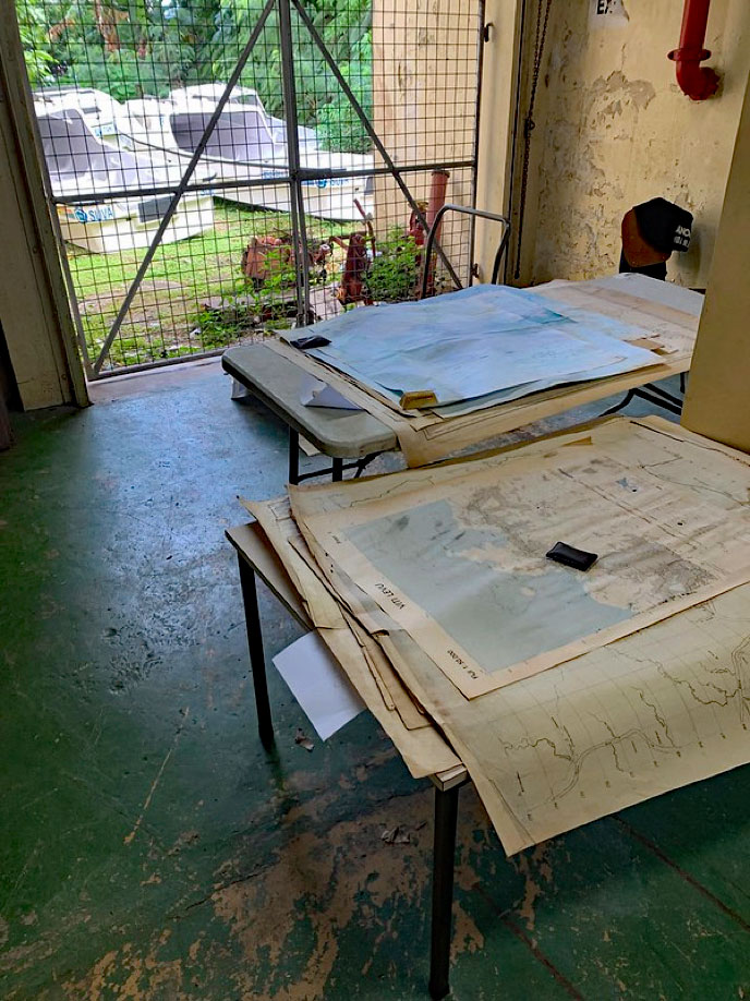
Without a permanent storage area, the maps had traveled around the old and new archive buildings and were stored wherever space could be found. On more than one occasion the collection sustained damage from a leaky roof while being stored in the old archives building. The maps had become brittle, dirty, and moldy. Some of the maps had been rolled so long that they broke into pieces when unrolling them. We knew, instantly, five years ago when this project was first proposed that we would need to perform some significant preservation work.
Knowing that we would need a large space to execute the project, we spent most of the first day of the project choosing a location. This was not easy as there was no space in the new archives building that could hold the participants and the large maps at the same time. Since the maps were being stored in a room in the old archives building, we decided that it would be easier to work on the project in this building. This would be easier than trying to carry all the fragile maps to the new building. The space we chose was right outside the room where the maps were and in the loading dock area. It was safe, secured, and had good ventilation. Several tables were then brought in and set up to ensure that we had adequate room to carry out the different phases of the project. We also designated another section of the old archives building as a spot for the discarded items.
The first phase of the project/workshop was to appraise the maps individually and determine what to keep and what to discard. The NAF staff decided that any map pertaining to the Fiji Islands was deemed important and unanimously kept. However, maps that depicted other Pacific Islands were discarded. For example, we found there were many maps showing the Solomon Islands or Vanuatu. If these were in good shape, they were set-aside with the possibility of being sent to the respected National Archives in the near future. We also came across a lot of duplicates, which we decided to discard unless they contained important hand written instructions or other phrases. Maps that were too deteriorated and broke apart at the touch were also removed. All in all, after appraising the items, which took a couple of days, we were able to miraculously cut our workload almost by half.
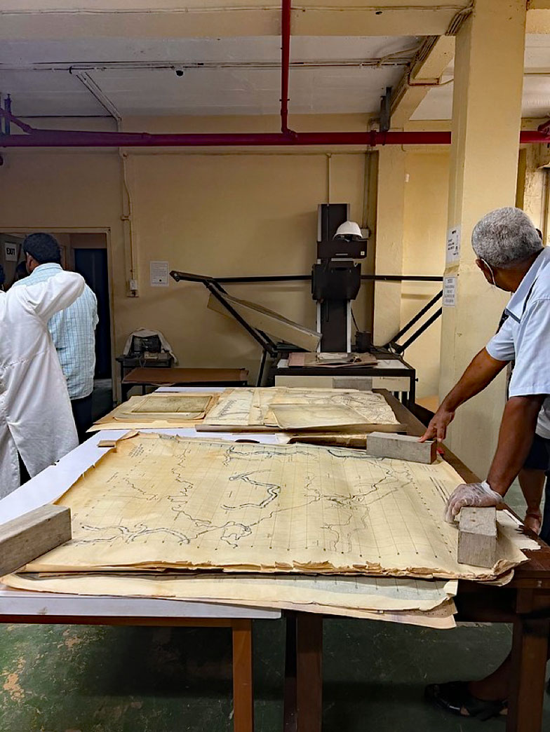
The next phase was to sort the maps in some kind of order. Since there was no original order, we were at liberty to create our own order and placed like maps or series together. For example, we placed similar Land Survey maps together. Fiji's Fire Control Maps created by United States Headquarters 37th Division Artillery was also placed together. General maps of the Fiji were sorted together by island. We also came across large architectural drawings of the colonial buildings of Suva (the capital town of Fiji) that we placed together, and a group of blueprints of the Lolomo Gold Mine that were sorted together as well. Amid the large maps, we found a collection of flags that were drawn by Fijian school children in 1969 and submitted as part of a contest to create Fiji's new national flag upon independence in 1970. These flags were artistically colorful, poignant and full of national pride. We cleaned and preserved these items and kept them together to form a one-box collection, which we felt could be used for future exhibitions during International Archives Day, or for one of Fiji's Independence Day celebrations.
Basic preservation techniques were also applied during this phase. All the documents had dust or dirt on them, so they were cleaned by gently brushing the debris off the maps. Moldy maps were set aside and isolated for a few days to allow the mold to dry. A large fan was used to help circulate the air in the room where the processing took place. Once the mold dried, it was then brushed away. On occasion we used archival tape to support tears, especially along creases that tore from the slightest touch.
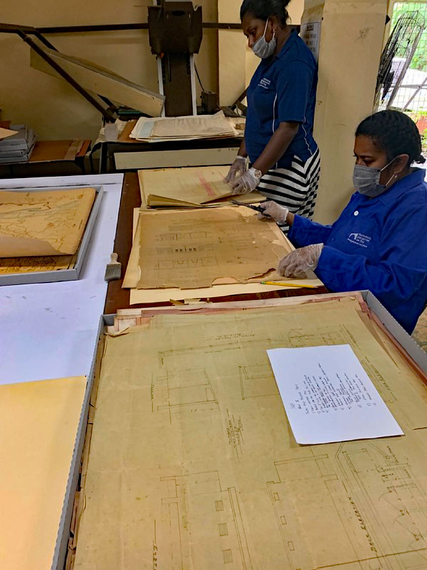
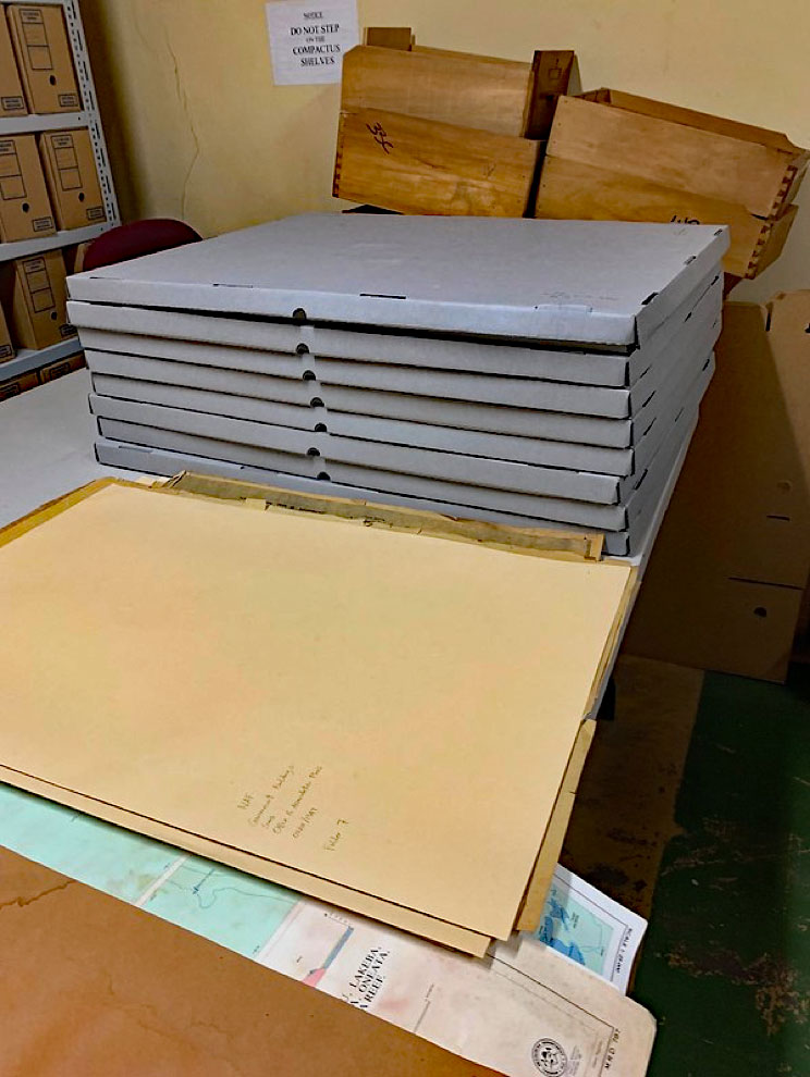
Archival supplies were purchased and shipped in April a few months prior to the start of the project. When the supplies finally appeared at NAF in June they looked as if they had traveled the world. Fortunately, the contents remained in excellent shape and arrived only a couple of weeks before the project start date much to relief of everyone involved. These supplies would prove to be instrumental during the fourth phase of the project where we rehoused the maps into new acid-free folders or archival boxes. I had also brought cleaning brushes, masks, and gloves that help keep the participants safe while working with the maps. Then, the project members would write in pencil the contents of the folder or box, which then would become the basis of a folder or box list. Eventually, these lists will be typed in a computer and will form the basis of a Finding Guide for the maps collection.
The last phase of the project was to deal with the discard pile, which was a slow and timely process. This the phase continued for a couple of days after the project was finished. Nevertheless, each discarded item needed to be listed as part of the archives' withdrawn or discard policy, and was executed by appropriate staff members. Decisions were made for maps that could be sent to other archives, or maps that will go to the trash/recycle bin. Naturally, maps that have deteriorated beyond salvage got the easiest decisions and were set aside to be recycled.
The same decisions will have to be made for the maps that were kept- whether to digitize them or not. There were some items that could merit digitization. For example, the Land Survey maps looked as though they were hand-drawn, as well as they were deemed to be quite important. One recommendation that came out of the project in regards to the Land Survey maps was to contact those at the Ministry of Itaukei Affairs and see what matching land survey maps they own. Perhaps, together, the two archives could fill in their gaps and coordinate the digitization of them so that access to them could be easier. Currently, the NAF does not have the capability to digitize oversize material. However, the organization has used outside companies for digitization projects in the past, and this could easily be done again.
Overall, the project/workshop was a complete success. We were anticipating that the project would take several months and were hoping to finish it by the end of the year. However, we were able to complete the majority of the work after about seven days. Our strict appraisal practices and policies helped us from the start and lighten the burden of records that we had to deal with. Additionally, the participant's determination, diligence and enthusiasm towards the project proved to be a very valuable asset in the quick completion of each of the different phases. It can be extremely difficult for staff members in the Pacific region to attend any kind of formal archival training. Thus, it was nice to see the participants take advantage of a hands-on training or workshop opportunity that comes along to them. There was a sense of pride when working on their own map collection. Now, the longevity of these records has been increased, as well as the access to these records has been made a easier. If other oversize material or collections get deposited to the Archives, the staff now will have the skills to deal with the records.
My most sincere thanks goes to Collin Yabaki and the Ministry of Education for their support of the project; the Interim Chief Archivist, Jim Balenaivalu, and the staff at the National Archives of Fiji: Salanieta Rakarawa, Makelesi Rokoleka, Jennifer Voka, Onisimo Volau, Kemueli Raiqeu, Penioni Kauvure- your hard work and camaraderie made the project a complete success; Taito Raione and Taniela Nayasi Soqo of the Ministry of Itaukei Affairs; International Council on Archives Fund for the International Development of Archives (FIDA); volunteer, Devin Oswald; and CEO Jasper Chou of East Lion Enterprises for the valuable help in shipping supplies to Fiji.
Vinaka vaka levu!